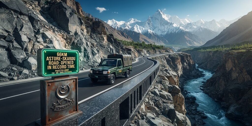
PAKISTAN ARMY COMPLETES STRATEGIC 66KM ASTORE-SKARDU ROAD IN RECORD TIME 🇵🇰🏔️🛣️🚜⚡
In a major engineering milestone across the rugged Karakoram and Himalayan corridors of Gilgit-Baltistan, the Pakistan Army (with its specialized engineering wings and the Frontier Works Organisation – FWO) has completed the strategic 66-kilometre Astore–Skardu road track.
Constructed through complex high-altitude terrain, narrow gorges, and vertical rock faces, the newly completed corridor directly connects Shagma in Astore with Manthokha in Skardu.
Beyond providing an all-weather alternative to the circuitous Jaglot–Skardu Road (S-1), the road restores direct vehicular connectivity for eight remote villages across the Gultari / Phoota Khas Valley, cutting travel times that previously took grueling multi-day journeys or long diversions down to just a few hours.
The project strengthens high-altitude defense mobility while unlocking ecotourism access toward the Deosai plateau, supporting local agriculture, and improving emergency healthcare access across the northern territories.
Here is an operational review of the route alignment, engineering specifications, regional connectivity benefits, and strategic impact for Gilgit-Baltistan.
Route Alignment & Engineering Feat
Constructing high-altitude roads through the permafrost zones of Gilgit-Baltistan requires advanced rock blasting, retaining-wall engineering, and avalanche-mitigation works:
               ASTORE – SKARDU CORRIDOR ALIGNMENT
 ┌─────────────────────────────────────────────────────────────┐
 │ STARTING NODE: SHAGMA (ASTORE DISTRICT)                     │
 │ • Connects upper Astore Valley settlements.                 │
 ├─────────────────────────────────────────────────────────────┤
 │ TRANSIT CORRIDOR: 66-KILOMETRE HIGH-ALTITUDE TRACK          │
 │ • Cuts across steep alpine passes and river valleys.        │
 │ • Incorporates engineered culverts, retaining gabions, and  │
 │   stabilized hillside cuts to counter seasonal landslides.  │
 ├─────────────────────────────────────────────────────────────┤
 │ EN-ROUTE BENEFICIARY: GULTARI / PHOOTA KHAS REGION          │
 │ • Reconnects 8 isolated mountain villages directly to both  │
 │   district headquarters.                                    │
 ├─────────────────────────────────────────────────────────────┤
 │ TERMINAL NODE: MANTHOKHA (SKARDU DISTRICT)                  │
 │ • Links seamlessly into the Kharmang / Skardu road grid     │
 │   near the famous Manthokha Waterfall tourism hub.          │
 └─────────────────────────────────────────────────────────────┘
The new bypass provides vital redundancy. Historically, when the primary Karakoram Highway (KKH) or the Jaglot–Skardu arterial faced seasonal blockages due to landsliding, Skardu and Baltistan faced prolonged freight isolation. The Shagma–Manthokha alignment provides an alternative transit vector.
Key Project Benchmarks & Regional Metrics
| Project Dimension | Operational Metric / Detail |
| Total Track Length | 66 Kilometres |
| Connecting Points | Shagma (Astore) to Manthokha (Skardu / Kharmang) |
| Direct Beneficiaries | 8 Isolated Villages in the Gultari / Phoota Khas Valley |
| Transit Reduction | Slashes inter-district travel between these sectors to a few hours |
| Executing Entity | Pakistan Army Engineering Formations / FWO |
| Economic Drivers | Livestock transport, fresh fruit freight (cherries/apricots), ecotourism, medical triage |
Socio-Economic & Tourism Transformation
The commissioning of the 66km corridor delivers immediate benefits for local communities and northern travel circuits:
            SOCIO-ECONOMIC IMPACT ACROSS NORTHERN VALLEYS
 ┌─────────────────────────────────────────────────────────────┐
 │ 1. RESTORING LIFELINE TO GULTARI VILLAGES                   │
 │ • Delivers year-round access to basic healthcare, emergency │
 │   hospital transfers, and higher secondary education hubs   │
 │   for communities cut off during heavy snowfall.            │
 ├─────────────────────────────────────────────────────────────┤
 │ 2. AGRICULTURAL & LIVESTOCK VALUE CHAINS                    │
 │ • Farmers in Astore and Kharmang can transport perishable   │
 │   dry fruits, apples, and livestock to commercial markets   │
 │   in Skardu and Gilgit without transport-delay rot.         │
 ├─────────────────────────────────────────────────────────────┤
 │ 3. DIVERSIFIED TOURISM CIRCUITS                             │
 │ • Creates a seamless loop: Astore -> Rama Meadows ->        │
 │   Deosai National Park -> Manthokha Waterfall -> Skardu.    │
 │ • Reduces single-route tourist bottlenecks in peak summer.  │
 └─────────────────────────────────────────────────────────────┘
Strategic Logistics & High-Altitude Defense Utility
Beyond civil administration, the Astore–Skardu link holds central national security significance:
- Logistical Redundancy: Provides armed forces formations with rapid, grade-engineered mobility across the Line of Control (LoC) forward sectors without depending exclusively on a single vulnerable highway.
- Rapid Disaster Response: Enhances National Disaster Management Authority (NDMA) and military rescue logistics during glacial lake outburst floods (GLOFs), cloudbursts, or severe winter avalanches.
- Infrastructure Synergy: Complements major ongoing road modernization projects in Gilgit-Baltistan, including the N-15 Babusar tunnel planning and Karakoram Highway upgrades.
Commercial Advisory & Northern Tourism Infrastructure Strategy
As strategic roads open up remote valleys, ecotourism hospitality, boutique glamping resorts, and sustainable mountain real estate gain long-term momentum. Real estate developers, eco-resort operators, and commercial investors seeking project feasibility, regional zoning advisory, and brand positioning along emerging Gilgit-Baltistan corridors can partner with Makani Marketing.
📌 Travel Advisory: While the 66-kilometer road track is officially through and operational, motorists, tour operators, and logistics hauliers should check seasonal weather warnings, ensure four-wheel-drive (4×4) readiness for rough-track mountain driving, and verify local administration permits during winter conditions.